The shifts in
real estate investment capital in the northern part of Ho Chi Minh City are no longer driven by sentiment; they are guided by a precise economic calculation: the speed of goods circulation and the emergence of key logistics corridors. In this context, the North Saigon urban area project, located in the heart of Phuoc Hoa, Ho Chi Minh City, holds a core position at a pivotal economic intersection.
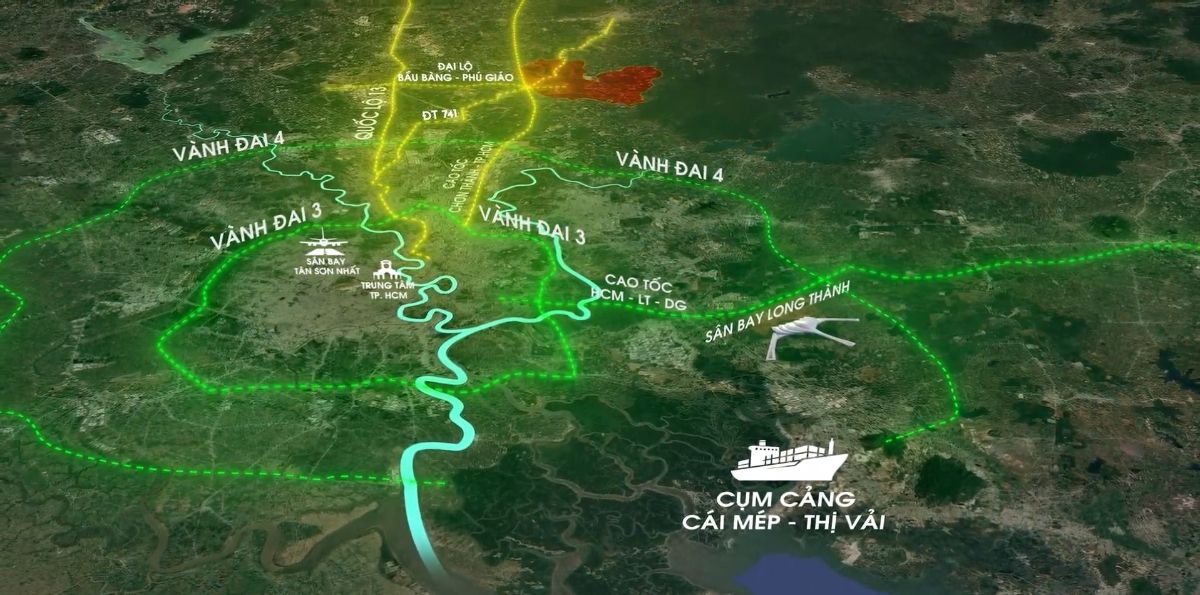
The infrastructure in northern Ho Chi Minh City is transforming from a system of single roads to an integrated transport network, where external transport corridors play the role of the 'arteries' feeding the entire economic zone.
MULTI-LEVEL LOGISTICS ECOSYSTEM
The vertical strategic axis CT.30 Highway (HCMC – Chan Thanh): With Phase 1 investment of about 17.4 trillion VND, this highway is a key artery that directly relieves pressure on National Highway 13. With a design speed of 100 km/h, CT.30 reduces travel time from production centers to Ho Chi Minh City’s financial center to under 60 minutes. The official groundbreaking in February 2026 marks a trigger for a growth cycle in asset value near the highway, with technical clearance scheduled for 2027.
The regional linkage axis DT 741 and the 'Ta Luc' road: DT 741 serves as a lifeline connecting the industrial capital Bình Dương with the raw material region Bình Phước and the Central Highlands. When combined with the Bắc Tân Uyên – Phú Giáo – Bầu Bàng 'Tạo lực' road, this network forms a grid-like transport system that optimizes time and transport costs between the industrial command centers.
The Belt 4 and its inter-provincial connectivity: The intersection of CT.30, DT 741, and Beltway 4 creates a seamless logistics artery. This route enables goods from the Central Highlands, passing through the northern Ho Chi Minh City industrial hub, to move directly to Long Thành airport and the Cai Mép – Thị Vải port complex without traversing the congested urban core, helping optimize supply chains for FDI companies.
The nucleus of the TOD urban model: Located at the frontage of DT 741 and adjacent to the Ho Chi Minh City – Chan Thanh Expressway ramp, the North Saigon urban area is not just a residential project but a bustling commercial hub, hosting headquarters of many global industrial players beyond just through roads.
A magnet for expert migration waves: The project sits at the heart of a green industrial park network of more than 18,600 hectares, adjacent to the Tan Bình (1,000 hectares) and the VSIP 2, 3, 4 mega industrial zones.
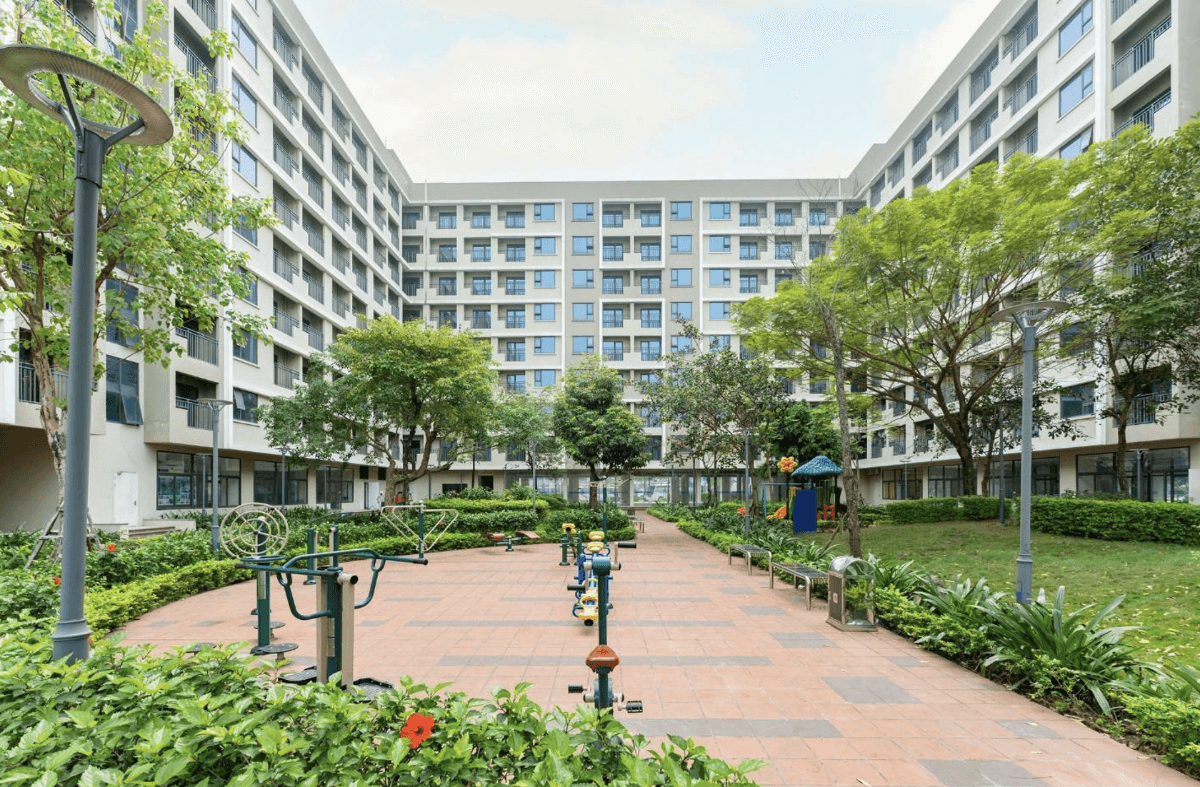
The all-in-one compound model and real-world economic calculations: To match its strategic intersection position, the North Saigon urban area is developed by Phuong Truong An Group on a 41.9-hectare site with more than 2,700 product types, laid out according to a closed compound model, eliminating the previous informal residential appearance.
Ecosystem of professional-grade amenities: The project integrates more than 39 premium facilities, such as a 10,000 m2 central park, an infinity pool, a go-kart track, and a mini golf course. These amenities not only serve leisure needs but also directly uplift asset values.
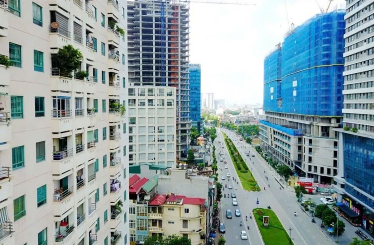
Investment strategy from the 'low-lying region': While prices in Thuận An or Dĩ An have established ranges of 40–80 million VND per m2, the North Saigon urban area opens opportunities starting at 1.139 billion VND per plot. With initial capital from 239 million VND, this presents an optimal financial model to seize the lead before the main infrastructure opens and to set new price levels in line with the development pace of the northern industrial hub of Ho Chi Minh City.
The North Saigon urban area offers not only a place to live but also a strategic economic position. It blends highway speed, the internal strength of industry, and the refinement of living space—core elements forming a new symbol of prosperity in the north.